

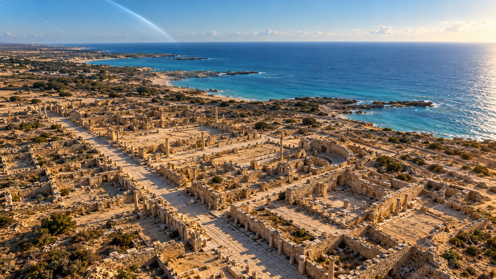
Modern satellite technology is helping Polish archaeologists investigate a nearly 2,000-year-old settlement on Egypt’s Mediterranean coast, bringing together space science and decades of research into the ancient world. Experts from the Polish Space Agency are working with Jagiellonian University researchers at Marina el-Alamein, where the remains of houses, public infrastructure and underground water systems offer evidence of everyday life during the Hellenistic and Roman periods.
The collaboration, announced by the Polish Space Agency (POLSA) on 22 October, forms part of the Polish-Egyptian El Darazya–Marina el-Alamein Conservation Mission.
Rather than using satellite technology to replace traditional archaeology, the researchers are combining images captured from orbit with observations, measurements and documentation gathered directly at the site.
- Find more news from Poland on our Homepage .
The approach could help specialists identify areas requiring further investigation, monitor changes around historic structures and plan conservation work without disturbing fragile archaeological remains.
An ancient settlement on Egypt’s Mediterranean coast
Marina el-Alamein lies west of Alexandria, close to the Mediterranean shoreline, in an area that was part of an important trading network connecting Egypt with other regions of the ancient world.
The settlement developed during the Hellenistic period and continued to flourish under Roman rule.
Excavations have revealed a substantial urban community with streets, residential buildings, public spaces and infrastructure serving its inhabitants.
Among the surviving structures are underground cisterns used to collect and store water, an essential resource in a coastal region with a dry climate.
The remains offer evidence of how people lived, traded and managed essential services almost two millennia ago.
However, the settlement’s exact ancient name remains uncertain.
Researchers have suggested that it may have been Leukaspis or Antiphrae, both names known from ancient geographical sources. Neither identification has been conclusively established.
The site’s modern rediscovery came in 1985–1986, when ancient remains were uncovered during construction work associated with a tourist development.
Polish archaeological investigations began soon afterwards, with the University of Warsaw’s Mediterranean archaeology specialists playing an important role in excavations and research.
The Polish Centre of Mediterranean Archaeology’s records document earlier investigations of streets, residential buildings and bathing facilities, including structures dating to the Roman period.
The latest research therefore builds on an established archaeological programme rather than representing the discovery of an unknown city.
How satellites can help archaeologists
The contribution of the Polish Space Agency is to give archaeologists a different perspective on the landscape surrounding the ancient settlement.
Satellite images allow researchers to study an archaeological site and its wider environment together, identifying patterns or changes that may be difficult to recognise from ground level alone.
At Marina el-Alamein, POLSA specialists are integrating remote-sensing information with archaeological documentation and observations made during fieldwork.
According to the agency, this can help identify historical and modern landscape features, highlight areas of potential archaeological interest and monitor environmental changes near the surviving ruins.
It may also allow researchers to investigate certain features without immediately undertaking intrusive excavation.


That is particularly valuable where ancient structures are fragile or conservation work needs to be carefully planned.
Satellite imagery can also provide a record of changes caused by modern development, environmental processes and other pressures on archaeological heritage.
However, the researchers have not announced that satellite analysis has already revealed a previously unknown building, street or buried monument at Marina el-Alamein.
The current project is focused on integrating the technology into archaeological investigation and conservation.
Polish researchers begin fieldwork
The archaeological component is being organised through the Institute for the Comparative Study of Civilisations at Jagiellonian University in Kraków.
The university’s 23 October fieldwork update identifies Dr Grażyna Bąkowska-Czerner and her colleagues as participants in the latest research.
The team reported completing its first week of work at El Darazya–Marina el-Alamein.
Researchers have been investigating the ancient settlement’s Greco-Roman culture and the everyday lives of its inhabitants, with field documentation including work at a residential structure designated H1.
The mission also involves cooperation with Egyptian specialists, whose participation is essential to research conducted on Egypt’s archaeological heritage.
Wrocław University of Science and Technology is contributing expertise in architectural conservation, while POLSA provides satellite imagery and remote-sensing support.
The arrangement brings together several different specialisms: archaeology to interpret the evidence, conservation science to protect surviving structures and space-based observation to study the surrounding environment.
Bąkowska-Czerner has extensive experience in the archaeology of ancient Egypt, particularly the Greco-Roman period.
Her earlier publications include research into Marina el-Alamein and its relationship with the wider Mediterranean world.
That background gives the current satellite-supported investigation a substantial foundation of archaeological knowledge.
Decades of Polish research in Egypt
Polish researchers have maintained a significant presence in Mediterranean archaeology for generations.
At Marina el-Alamein, systematic Polish excavations began in 1987, followed by a Polish-Egyptian conservation mission established in 1995.
Earlier work investigated burial grounds, streets, houses and public buildings, gradually revealing details of the settlement’s organisation and architectural development.
The present collaboration between POLSA and Jagiellonian University introduces an additional technological dimension to that longstanding research tradition.
It also demonstrates an increasingly important application of space technology: using satellite observations not only for communications, navigation or environmental monitoring, but also for protecting cultural heritage.
POLSA has not published a timetable for completing the satellite analysis or announced specific new archaeological discoveries resulting from the collaboration.
Nevertheless, the first stage of cooperation is under way, and the university has confirmed active fieldwork.
For the researchers working among the ruins of Marina el-Alamein, the significance lies in combining two very different perspectives on the same ancient settlement.
The stones, streets and water systems provide evidence from the ground. Satellite observations offer a broader view of the landscape around them.
Together, they could help archaeologists build a more complete picture of an Egyptian coastal community whose surviving remains have been studied by Polish specialists for almost four decades.