

Poland is expanding its ability to monitor floods, wildfires and dangerous river-ice conditions through a new satellite-services agreement announced on Thursday, 12 November. Polish-Finnish space technology company ICEYE and the Space Research Centre of the Polish Academy of Sciences have agreed to provide Poland’s civil-security network with standing access to disaster-monitoring tools, including a system that the company says can forecast major flooding up to four days in advance.
The agreement will make ICEYE’s satellite monitoring services available through Civil Security Hub Poland, a scientific and technological partnership supporting emergency services and crisis-management authorities.
The hub operates as Poland’s national node within the European Space Agency’s Space Resilience Nodes initiative, which aims to improve how European countries use information from space during natural disasters and other emergencies.
- Find more news from Poland on our Homepage .
The agreement’s most significant change is how the technology will be accessed.
Rather than having to activate satellite-monitoring services separately whenever a flood or another emergency develops, the Polish hub will have standing access through a subscription arrangement.
The agreement announced jointly by ICEYE and the Space Research Centre covers flood forecasting and mapping, wildfire monitoring and seasonal observation of ice on rivers.
The services are intended to support Poland’s State Fire Service, regional crisis-management teams and hydrological authorities.
Flood warnings up to four days in advance
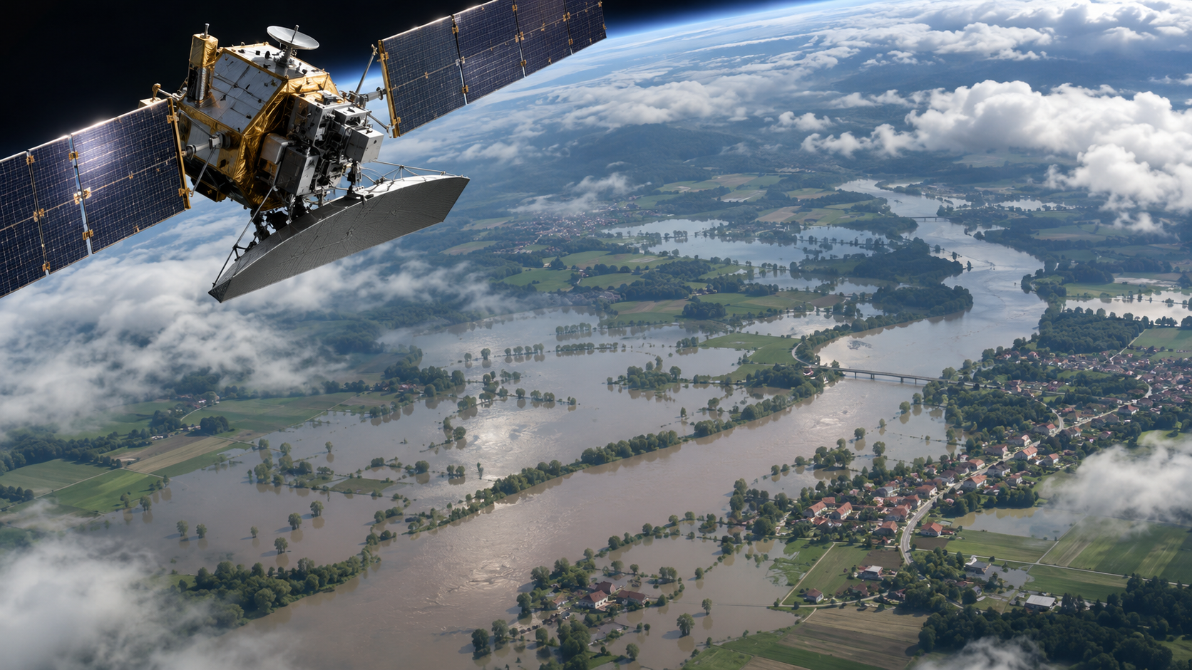
The most developed component of the agreement is ICEYE’s Flood Solutions Suite.
The service combines advance forecasting with satellite observations collected as flooding develops.
According to ICEYE, its Flood Early Warning product can forecast the likely impact of major flooding up to four days before an event.
The forecasts draw on weather and hydrological information, flood-hazard data and modelling to identify areas potentially at risk.
Advance information could help emergency managers decide where to deploy personnel, prepare equipment or organise protective measures.
Once flooding begins, another component, Flood Rapid Impact, uses satellite observations to identify the areas covered by water.
ICEYE says the system can produce flood-extent maps within hours and update them as frequently as every three hours, depending on the available observations and operational conditions.
A third service, Flood Insights, provides more detailed assessments following a flood’s peak.
The information can include the estimated depth of floodwater, the geographical extent of flooding and the potential impact on individual buildings.
According to the company, those assessments can be delivered within 24 hours of the flood’s peak, with further updates as conditions change.
These capabilities are intended to give emergency services a more complete picture of an event before, during and after the flooding.
They do not guarantee that every flood can be predicted four days in advance or that every affected area can be mapped at a fixed interval.
How radar satellites see through clouds and darkness
The technology relies partly on a form of satellite imaging known as synthetic aperture radar, or SAR.

Unlike conventional cameras, radar satellites transmit signals towards the Earth’s surface and analyse the signals reflected back.
This allows them to collect observations at night and in conditions that make ordinary optical photography difficult, including cloud cover, rain and smoke.
During serious flooding, those capabilities can be particularly valuable.
Heavy rainfall and persistent cloud often coincide with the periods when emergency services most urgently need information about rising rivers and flooded settlements.
Satellite radar can help identify changes in the landscape, including areas where water has spread beyond normal river channels.
The resulting images are processed into maps that can be interpreted by crisis-management teams.
ICEYE has built a large constellation of radar satellites and supplies Earth-observation information for defence, government, environmental and commercial applications.
Its published explanation of its flood-monitoring technology describes how forecasts and observed satellite data can be combined to support decisions about flood exposure and potential damage.
Radar observations are not a substitute for rainfall forecasts, river gauges or measurements taken on the ground.
Their value is in adding another source of information, particularly when visibility is poor or obtaining a complete ground-level picture is difficult.
New wildfire-monitoring pilot
The agreement also includes a pilot service for tracking wildfires.
This component will combine ICEYE’s radar and optical satellite observations with thermal-detection technology supplied by German space technology company OroraTech.
Thermal sensors can identify heat anomalies associated with active fires.
Radar observations can then provide complementary information about affected terrain, including when smoke or darkness limits conventional imagery.
The combined approach is intended to help authorities identify active fires, assess damage to buildings and map areas affected by burning.
It could also support emergency teams working in remote or difficult-to-access locations, where obtaining a comprehensive view from the ground is challenging.
However, the wildfire element is described as a pilot service, rather than a fully validated nationwide fire-detection system.
Satellite-based wildfire monitoring has limitations.
According to OroraTech’s own technical guidance, detection depends on factors including satellite coverage, fire intensity, observation conditions and the timing of satellite passes.
Small or short-lived fires may be missed, while thick clouds can interfere with thermal observations.
The combination of several types of sensors is intended to reduce such limitations, not eliminate them.
Poland will also test monitoring of river ice
A third component addresses a less familiar but potentially dangerous source of flooding: the accumulation of ice in rivers.
During winter, ice can form on rivers and begin moving downstream.
Under some conditions, broken ice accumulates into barriers known as ice jams.
These obstructions can restrict water flow, causing river levels to rise rapidly and potentially flooding nearby settlements.
ICEYE will provide a river-ice monitoring service for validation in Poland during winter and spring.
The service is intended to track ice formation and movement, offering authorities additional information about developing conditions.
The announcement does not establish that the system has completed operational validation or that it can reliably predict the timing of every ice jam.
Its performance in Polish conditions will be an important part of the testing.
Poland already used ICEYE satellites during the 2024 floods
The new agreement builds on previous cooperation rather than introducing satellite disaster monitoring to Poland for the first time.
In September 2024, Central Europe experienced extensive flooding associated with Storm Boris.
Poland was among the affected countries, with particularly serious damage in the south-west.
During the emergency, the Crisis Information Centre of the Polish Academy of Sciences activated satellite monitoring to support emergency services.
According to a 27 September 2024 report published by the Space Research Centre, the system was activated on 13 September as the flood situation deteriorated.
Specialists worked with ICEYE to identify flooded areas using radar satellite observations.
The information was supplied to Poland’s State Fire Service, regional crisis-management centres and the Institute of Meteorology and Water Management, known as IMGW.
The research centre reported that satellite-derived data and assessments were reaching emergency-management teams at intervals of several hours.
ICEYE says its flood products were a principal source of information about inundation during the first four days of the emergency.
That assessment comes from the organisations involved in delivering the service, rather than an independent evaluation of its effectiveness.
Nevertheless, the 2024 response demonstrated how satellite monitoring could be integrated into the practical work of Polish emergency authorities.
Jakub Ryzenko, head of Civil Security Hub Poland and the Polish Academy of Sciences’ Crisis Information Centre, said the earlier experience had shown the value of rapidly delivering satellite information to emergency managers.
The new agreement is intended to make those capabilities more readily available during future emergencies.
What is Civil Security Hub Poland?
Civil Security Hub Poland, or CS Hub PL, brings together scientific institutions, space technology companies and specialists working with Poland’s emergency and civil-protection services.
It is led by the Crisis Information Centre at the Space Research Centre of the Polish Academy of Sciences.
Its partners include ICEYE, CloudFerro, Warsaw University of Technology and the European Space Foundation.
The hub combines satellite observations, drone imagery, specialist analysis and digital tools to produce information that emergency responders can use.
The objective is not simply to collect more satellite images.
It is to process complicated technical data into understandable products that can support operational decisions.
For example, instead of presenting emergency coordinators with raw radar measurements, the system can supply interpreted flood maps showing which areas may be affected.
The Polish Academy of Sciences’ description of Civil Security Hub Poland identifies closer cooperation between technology developers and emergency responders as one of the project’s central aims.
The hub also tests new products and provides training to help public authorities incorporate satellite-derived information into established procedures.
Part of a wider European disaster-response initiative
The agreement forms part of the European Space Agency’s broader efforts to strengthen Europe’s ability to respond to crises using space technology.
Under the Space Resilience Nodes initiative, participating countries are developing national capabilities that can exchange information and support one another during emergencies.
Poland’s hub is among the early examples of this approach.
The intention is to make satellite information more accessible to authorities without requiring each country to build every element of its own space infrastructure.
Countries could also support one another when disasters affect several regions or cross national borders.
Under the new arrangement, Polish teams may provide assistance to partner countries upon request.
This could be relevant during major river floods that affect more than one European country, or wildfires that threaten areas near national borders.
ESA has separately been strengthening its relationship with Poland.
In July 2026, the agency and the Polish government announced plans for a new ESA civil-security and resilience centre in Warsaw.
That planned centre is a separate development from the ICEYE subscription agreement, although both reflect a broader European interest in space technology for public safety.
A Polish-Finnish company with growing international reach
ICEYE was founded in Finland and has strong Polish links through its co-founder and chief executive, Rafał Modrzewski.
The company specialises in radar satellite technology and has expanded its activities across civilian, governmental and defence markets.
Its technology has become increasingly prominent in Poland, including through military Earth-observation programmes.
Poland-24 previously reported on security concerns involving an ICEYE satellite associated with Ukraine, illustrating the company’s role in a very different application of space technology.
The new civil-protection agreement demonstrates how similar underlying radar-observation capabilities can be used to support disaster management rather than military intelligence.
For the Polish Academy of Sciences, it is also another example of research and technical expertise being applied to operational public-service needs.
What happens next?
ICEYE and the Space Research Centre announced the contract on 12 November 2026.
The subscription arrangement gives Civil Security Hub Poland standing access to the agreed disaster-monitoring services.
However, the announcement does not specify a single operational commencement date covering every component.
The wildfire service remains a pilot, while the river-ice monitoring service is to undergo validation during winter and spring.
Neither the contract’s financial value nor its precise duration was disclosed in the announcement.
It also remains to be established how frequently the new services will be used in live emergencies and how their operational performance will be assessed by Polish authorities.
For emergency services, the potential benefit is straightforward: earlier information about approaching floods, more timely maps during disasters and improved awareness of hazards that can be difficult to observe from the ground.
But the technology cannot prevent extreme weather, stop wildfires or replace decisions made by emergency responders.
Its success will ultimately depend on whether satellite information reaches the right authorities quickly enough, is sufficiently reliable and leads to better decisions during real emergencies.